


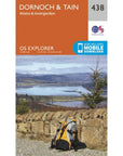
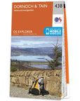
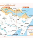
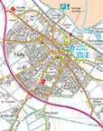
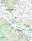
The Ordnance Survey Explorer Map 438 Dornoch & Tain is the most detailed folding map and is recommended for anyone enjoying outdoor activities including walking, horse riding and off-road cycling. Providing complete GB coverage, the OS Explorer map series details information essential in the great outdoors, including youth hostels, pubs and visitor information. Rights of way, fences, permissive paths and bridleways are clearly shown, ensuring you have the best information to get the most out of your time in the countryside.
Ordnance Survey Explorer Map 438 Dornoch & Tain Features:
- Highland
- Dornoch
- Tain
How to access the digital version of this map
This map comes with a digital version which you can download to your smartphone or tablet.
Go to OS.uk/redeem for more details (terms and conditions apply).
Scratch off the panel on the inside cover of the map to reveal a code, you are then just three easy steps away from downloading your digital map. If the scratch panel has already been scratched off or if you have any problems downloading your map, please call the OS Customer Service Centre on 03456 050505.
We aim to ship out all orders placed before 2pm the same working day! For shipments in the United Kingdom mainland, we use Royal Mail Tracked 24 service (DPD Next Day for larger items and items that weigh over 4KG). Please see our shipping policy for more details.
Summits is your premier destination for outdoor equipment, featuring top-quality brands and exceptional after-sales service. Before you use a product purchased from us, let's cover some key return details and warranty issues by clicking here.